

Geography and Economic Growth
Geography and Economic Growth
My review of Jared Diamond's interesting book "Guns, Germs, and Steel".


Guns, Germs and Steel by Jared Diamond, published in 1997, is a fascinating book. The main thesis is that geography was the primary factor determining economic output until around the 1500s, with the axis of the continents playing a key role. The focus on the axis is due to the fact that areas along the equator tend to be hotter, while things get colder the further away you move from it. Although other factors such as altitude, mountains, and ocean currents can also influence climate, areas with similar climates are generally aligned parallel to the equator.
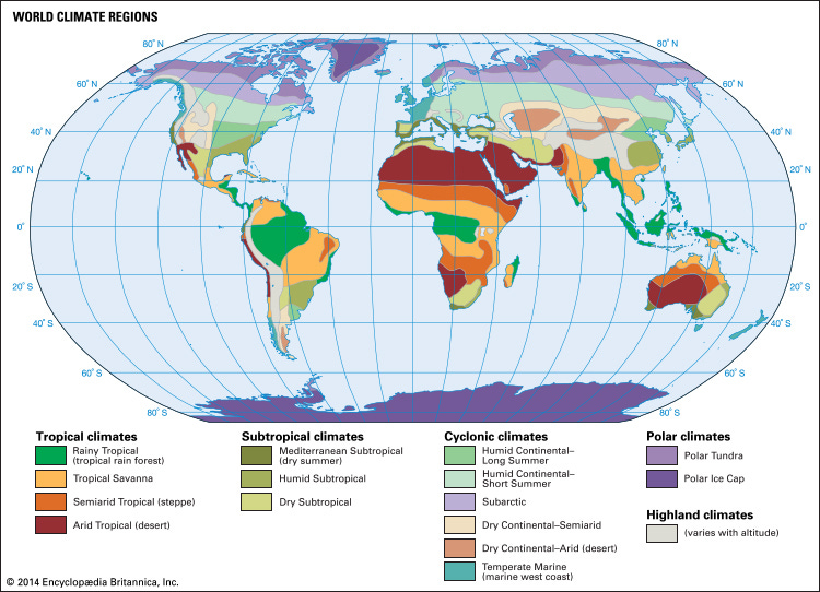
Given that areas of a similar climate are typically aligned on an east-west axis, and Eurasia had more of these areas due to its east-west orientation. This made trade and all sorts of other things more likely, as moving between areas with similar climates was easier. Empires such as the Greeks, Mongols and Russians were able to conquer and connect large parts of Eurasia. One example of this interconnectedness is the silk road — a network of trade routes that linked China to the Mediterranean.

Due to the vast size of Eurasia, there was a greater variety of potential animals and plants to domesticate. Once domesticated, these could easily spread to other parts of the continent. This large variety of plants and animals to domesticate increased agricultural productivity, which allowed for large urban centres, city states, and eventually empires. Trade routes also facilitated the spread of technologies and ideas, such as gunpowder and paper originating in China, which spread along the silk road to Europe.
As the trade routes carried plants, animals, and ideas, it also carried diseases. An example is the black death in Europe which likely originated in east or central Asia. This resulted in multiple endemic diseases, and over time, Eurasians developed immunity. Eventually when Eurasia connected with the America’s, parts of Southern Africa, and Australasia, the differences in immunity was devastating to their indigenous populations.
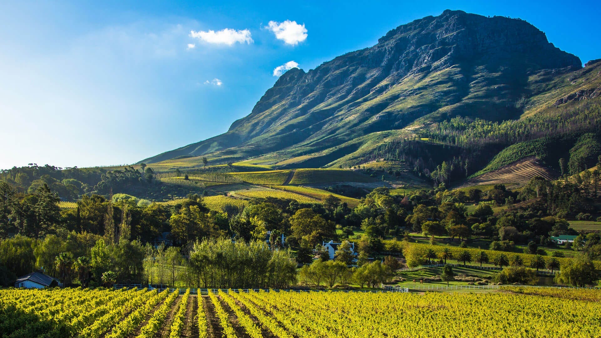
An excellent example of the role of the orientation of continents — in limiting trade, the diffusion of ideas and domesticated plants — is to focus on South Africa’s Cape region. The Cape Winelands region is ideal for grapes and other Mediterranean crops. Prior to Dutch colonisation in 1652, the Cape mostly had a hunter-gatherer population — with the domesticated plants available not being sufficient to increase agricultural productivity and have settled urban areas. While the domesticated plants in the rest of Southern Africa struggled in the Cape’s long dry summers.
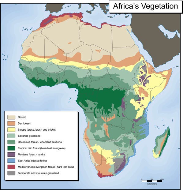
The ideal crops for the Cape had been domesticated in Africa and used for thousands of years before Dutch colonisation. However, these were on the other side of the continent. Travelling through Africa, given its north-south axis, would involve going through multiple climate zones. Thus, it is the orientation of Africa which limited trade, the diffusion of ideas and domesticated plants. Eventually when the appropriate crops eventually made it to the Cape, it came through ships and not by land. Interestingly, several domesticated animals managed to make their way to the Cape before the colonial period such as cattle, sheep and dogs.
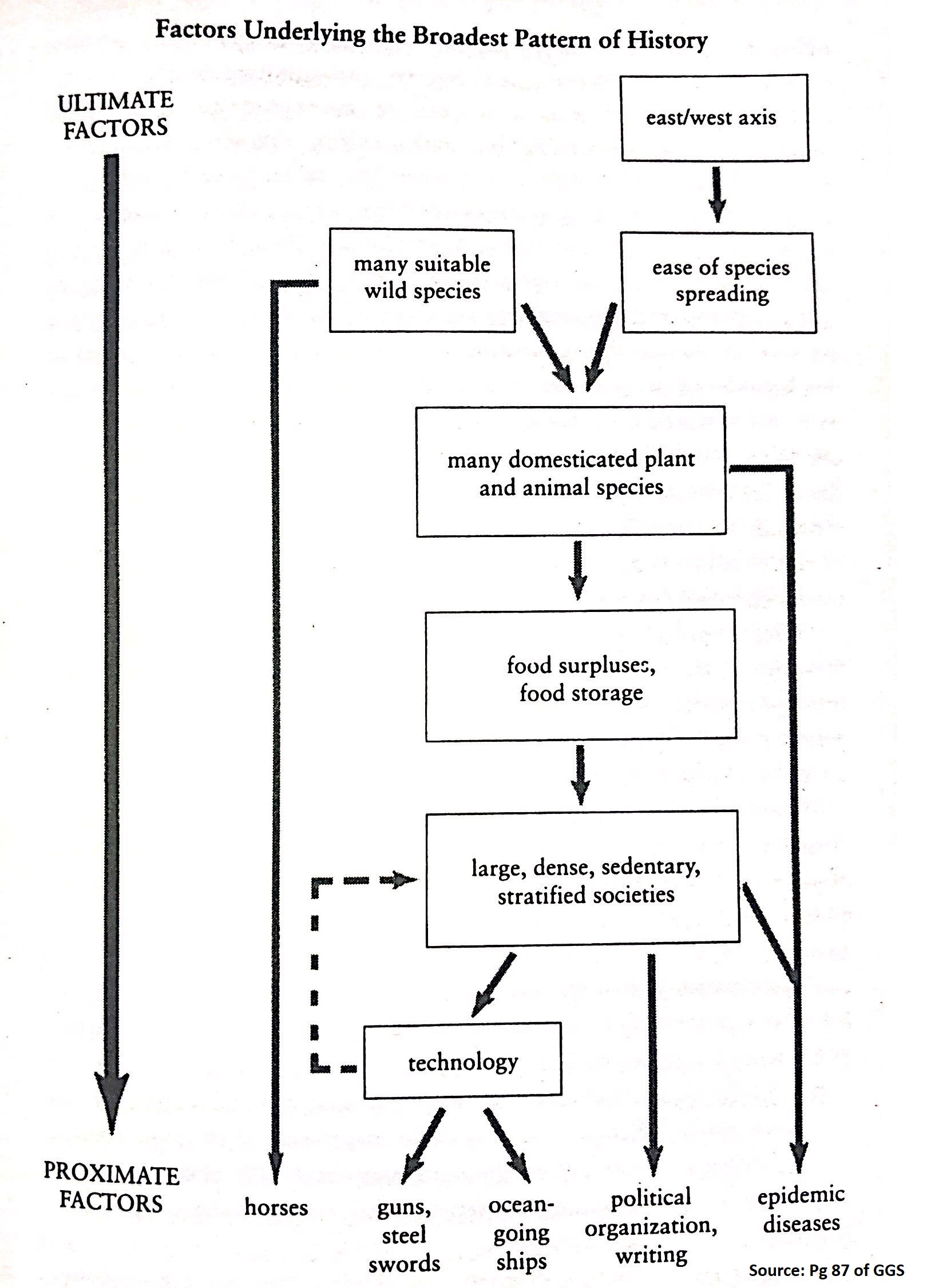
How the axis of continents relates to other proximate factors of economic output — such as horses, technology, political organization, and diseases — is shown above. These proximate factors of economic development for most of history, has the ultimate factor of geography.
While there are many other ways in which geography affects growth — these include the role of malaria, the distance from the coast and navigable rivers, having a temperate climate, resources endowments, and many more. Diamond’s idea is probably the most ambitious in its attempt to describe most of human history.
This is how Gallup, Sachs and Mellinger describe Diamond’s thinking:
“Diamond (1997) also argues that because plant species and domesticated animals appropriate to one ecological zone may be inappropriate elsewhere, technological diffusion works most effectively within ecological zones and therefore in an east-west direction along a common latitude rather than in a north-south direction. Eurasia, he claims, enjoyed the benefit of its vast east-west axis heavily situated in temperate ecological zones, whereas Africa was disadvantaged by its north-south axis, which cuts across the Mediterranean climate in the north, the Saharan Desert, the equatorial tropics, and the southernmost subtropical regions. Diamond argues that these advantages, in addition to more contingent (i.e., accidental) advantages in indigenous plant and animal species, gave Eurasia a fundamental long-term advantage over the rest of the world.”
Historians really don’t like Diamond’s reasoning, seeing it as “environmental determinism” with a limited role for human decisions. I agree with this point. A definition of humans is Homo Faber — one who controls their environment through tools. We have the power to influence our own environments, both in good ways and bad. While geography likely played a role in the past, it has increasingly less so over time. Geography is no longer destiny.